
11th IAG International Conference on Geomorphology
- TARN Team

- Feb 6
- 7 min read

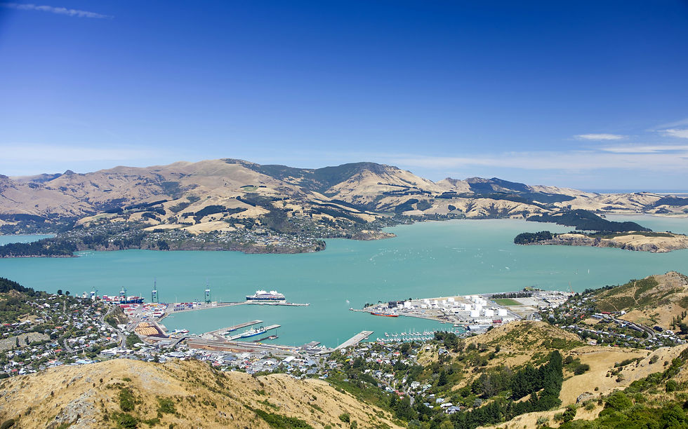
The TARN team headed to the 11th IAG International Conference on Geomorphology in Ōtautahi Christchurch, where researchers from around the world gather to explore the science of landscapes and the processes that shape them. Held 2–6 February 2026, the conference brings together geomorphologists through scientific sessions, workshops and field trips that connect research with real-world landscapes and communities.
We were excited to learn from global perspectives, build new collaborations and exploring how geomorphology and cultural storytelling can help guide more sustainable futures.
Outdoor activities and digital technologies for geoheritage popularisation: Outcomes from IGCP 714
Tuesday Feb 3: Dr Mark Williams
The IGCP 714 project “3GEO – Geoclimbing & Geotrekking in Geoparks” has been sponsored by the International Geoscience Programme (IGCP) and supported by the International Union of Geological Sciences (IUGS). The aim was to develop a robust workflow to integrate digital technologies into geoscience communication, and to create Digital Outcrop Models (DOMs) of geosites and geodiversity sites used for recreational climbing and trekking. The first phase of the project identified the criteria most suitable for selecting geodiversity sites equipped for climbing (geoclimbing sites) or explored through trekking (geotrekking sites). More than 20 geoclimbing sites and 30 geotrekking sites were selected in UNESCO Global Geoparks, aspiring geoparks or geopark project areas across 14 countries, as well as in other protected areas featuring geoheritage sites. The scientific and other additional site values, along with their potential for use, were the key criteria for identifying suitable contexts to explore the link between outdoor activities and Geoscience education.
Using technologies such as UAVs, tablets, and smartphones equipped with LiDAR sensors, the workflow model identified in this project allows the acquisition and creation of DOMs that can be integrated into web-GIS applications and Virtual Reality experiences (https://arcg.is/00umX9), offering interactive educational content. The workflow is designed to support practitioners globally in selecting the right tool for data acquisition and to learn how to construct DOMs for public and student engagement. These DOMs can also be used for geoconservation through monitoring of dynamic sites based on the repeated acquisition of geospatial data. The collection of DOMs in the project members territories is available via a Sketchfab repository (https://sketchfab.com/3geo714/models) and using an ArcGIS Online web application (https://arcg.is/1SH8Hr1). The database includes geological and geomorphological descriptions, that in the future will be implemented on the DOMs in the form of annotations.
SOS - Save Our Soils via strategic geoconservation and heritage protections
Thursday Feb 5: Dr Melinda McHenry
Saving Our Soils - vulnerable to erosion, compaction, pollution, burial and hazards - is of dire urgency, given that less than 30% of the world's soils remain in acceptable condition. However - what of the cultural and intrinsic values of soils, in a world dependent on their utility and service provision? Here, I describe how we may optimally valorise and conserve soils, as heritage geomorphology - geoheritage.
Using Australia as a case study - I propose a framework to assess and prioritise soils for geoconservation, integrating scientific, cultural, and geosystem service (GSS) values and incorporating vulnerabilities and risks. I show how soils can be evaluated and valorised using assessment criteria adapted for soil-specific indicators of fertility, structure, earth history, susceptibility, and cultural relevance. In presenting these significance values and unique vulnerabilities (sensitivities and exposure considerations) of soils, I show how and where soils of geoconservation and heritage significance can be identified and prioritised.
The construction of this framework highlighted the often competing territorial conservation and human development objectives that impede current soil geoconservation. Like many territories, systematic and representative heritage geoconservation of soil is hindered in Australia by an agricultural paradigm, regulatory fragmentation, protected areas elevation bias, and a narrow interpretation of significance. Fertile soils are rarely reserved, while depauperate soils are broadly, but incidentally protected. Paleosols rich in earth history and rarity significance value, remain largely unrecognised by virtue of documentation via single-area studies.
Existing policy instruments prioritise soil hazard and pollution avoidance over intrinsic heritage protections. Even the extensive geographic extent of reserve protections afforded by Indigenous Protected Areas (IPAs) often skew towards preserving marginal soils, raising concerns of environmental and cultural justice.
The repositioning of soils as heritage geomorphology is essential for effective geoconservation. Successful soil geoconservation will require assessment instruments that embrace utility and cultural value.
Participatory Approaches to Geocultural Valorisation and Risk Assessment in Indigenous Territories in the Parecis Basin, Cerrado region of Brazil.
Thursday Feb 5: Raiza Sartori Peruzzo
Lack of known geocultural values can affect geoheritage interpretability and impede efforts by Indigenous Peoples to use their lands in accordance with their spirituality and desires for social, ethical, environmental and economic autonomy. Allowing First Nations peoples to use their own voice and to choose which sites or places are permitted to be discussed and considered in potential future geoconservation activities is a first step to self-determination and participatory land use for geotourism. We used participatory action research with Indigenous Tribes of Tirecatinga, Irantxe, and Utiariti Indigenous Territories in Brazil to highlight the cultural values of abiotic sites.
The methodology involved primary and secondary data, including oral histories from Indigenous leaders, site degradation and threats assessment. With a new understanding of the geocultural values of the abiotic sites, we then evaluated risks to the integrity, geomorphic functions and cultural values. We identified 3 sites that had high value in ecological, aesthetic and geocultural domains. They exhibited aesthetic value due to their natural beauty, and rich spiritual interpretations. We also noted geoscientific, educational, and economic values, such as their role in regional geological understanding, non-formal education, and potential geotourism development. We found that risks decreased with reduced tourist accessibility and stronger territorial protections, irrespective of geocultural site geology or geomorphology.
The framework is easy to use and can translate into actionable criteria for protected areas and other forms of statutory land use protections or geotourism planning and management. Most importantly, for the peoples of the studied Territories, it has provided them with an opportunity to show what is special and highlight their ongoing desire for formalised protection of their lands. Our approach emphasised territory-specific geocultural values and underscores the necessity of addressing both physical and cultural aspects of development on Indigenous lands and integrating Indigenous perspectives into geoconservation efforts.
Challenging Authorised Heritage Discourse: Recognising Indigenous Cultural Geomorphology in Australian Conservation Planning
Thursday Feb 5: William Plumb
Cultural geomorphology—the intersection of landforms, meaning, and identity—offers an important yet underutilised lens for understanding geomorphological heritage in Australian settler-colonial contexts. While geoheritage is increasingly recognised for its scientific, educational, and aesthetic values, Indigenous geocultural values remain marginal in conservation planning. This research addresses this gap by developing and applying a novel framework for identifying and classifying geomorphological heritage with Australian Indigenous cultural significance.
Through mixed-methods content analysis of protected area management plans across Tasmania, New South Wales, and Indigenous Protected Areas, this research utilised a design thinking methodology to develop a heuristic framework for identifying geocultural values. The framework distinguishes between two tangible categories—geological artefacts and landforms as cultural sites—and two intangible categories—geodiversity as cultural narratives and cultural practices in geodiversity. This classification aims to move beyond the dominant focus on tangible features in heritage assessments by recognising the cultural significance embedded in both physical and experiential relationships with landforms.
Findings indicated that state-managed reserves predominantly emphasised tangible values—particularly geological artefacts—while intangible connections to geodiversity, such as those expressed through stories ceremonies, and relational land-based practices, remain underrepresented. Indigenous Protected Areas demonstrated more holistic recognition of geocultural values, recognising both tangible and intangible value more frequently. Deeper analyses revealed that planning language and institutional governance often constrained what was considered legitimate heritage, with classifications and legislative systems rarely accommodating Indigenous perspectives.
This research contributes to heritage geomorphology by offering a categorical framework that expands conventional understandings of geomorphological heritage. It highlights the need for inclusive methodologies that acknowledge both the physical characteristics and the cultural significance of landforms. By integrating and recognising Indigenous and Western knowledge systems, this approach strengthens the protection, management, and interpretation of geoheritage and promotes more equitable conservation outcomes.
Geodiversity, Geoheritage & Wildfire Hazards - Tools for Assessment and Management
Friday Feb 6: Ruby Hoyland
Effects of wildfire on geodiversity elements such as soils, geology and landforms are highly variable, and poorly understood. In protected and conserved areas, misunderstandings and information deficits regarding wildfire and geodiversity have previously resulted in poor geoconservation outcomes. Wilfire can modify and/or diminish intrinsic and cultural values of geodiversity (as geoheritage). Wildfire-induced degradation of geosystem services can also result in other adverse nature conservation outcomes.
Over the past three years, we have sought to systematically address geoconservation issues arising from wildfire hazards. In this presentation, we will review the outcomes of this research, and discuss early and emerging findings from our current and developing wildfire projects.
We will first document our recent qualification and quantification of the immediate post-fire modifications to geodiversity elements and values. We will then show the development of quantitative relative geodiversity sensitivity indices, to be used in hazard planning and conservation mapping. We then discuss our emerging research that developed wildfire exposure parameters relevant to geodiversity and geosites - and show how these parameters can be incorporated into multi-criteria decision analyses and wildfire hazard planning.
We now know from speaking with protected area fire managers and scientists from 30 wildfire prone countries that financial, data paucity and awareness constraints impede meaningful 'wildfire aware' geoconservation. Upon acknowledgement of these constraints, we show how the indices and decision-support tools discussed earlier can be recalibrated and repurposed for fire managers and practitioners unfamiliar with geodiversity or geoheritage significance.
Our research is first to incorporate quantitative and qualitative dimensions to examine wildfire and geoheritage. The aim of this presentation is to describe the results arising from our novel integration of geographic and geomorphic methods and to contextualise these via user-informed and technical tools that aide in future wildfire protections and management.
Highly Commended Student Oral Presentation
08I: Heritage Geomorphology: a new branch of geomorphological studies? Concepts, methods and practices
William Plumb - Challenging Authorised Heritage Discourse: Recognising Indigenous Cultural Geomorphology in Australian Conservation Planning
09I: Heritage Geomorphology: a new branch of geomorphological studies? Concepts, methods and practices
Raiza Sartori Peruzzo - Participatory Approaches to Geocultural Valorisation and Risk Assessment in Indigenous Territories in the Parecis Basin, Cerrado region of Brazil.

Comments